
In brief
- GPX is a text file containing route coordinates. It is opened by a map app, not by a text editor.
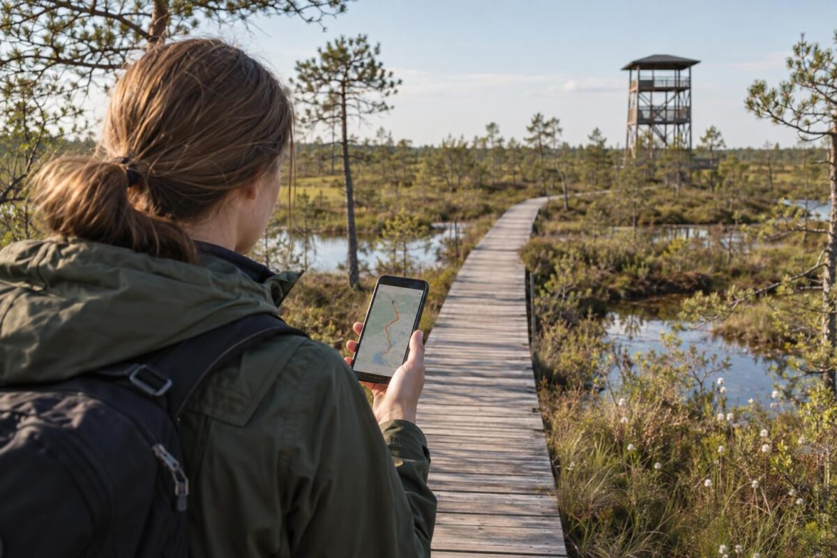
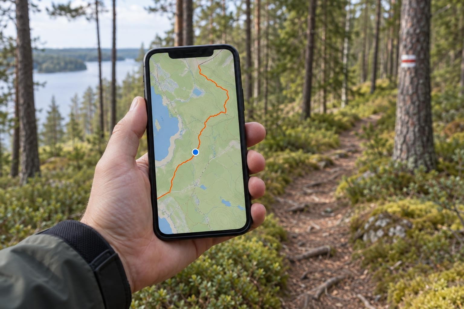
- On the route page, press the GPX button and open the file in a map app; the line will appear on the map together with your location.
- OsmAnd and Organic Maps, for example, can be used free of charge and without internet. OsmAnd can be used free of charge to follow the track with navigation.
- Download the map at home: in forests and bogs there is often no mobile internet, but GPS also works without it.
What is GPX
GPX (GPS Exchange Format) is an open format for exchanging routes between apps and GPS devices. It contains plain text (XML) with coordinates in the WGS84 global system and, where available, elevation in metres. For this reason, the same file can be opened on a phone, a watch, a cycle computer or a computer.
A GPX file can contain three types of data:
- Track (track): a dense series of points that precisely follows the line of the road, including the bends. Each point has a latitude, a longitude and usually also an elevation. Routes LV files contain precisely a track.
- Route (route): sparser turning points, between which the app calculates the way itself. If the app chooses the way on its own, the result may differ from the intended one.
- Points (waypoints): individual places with a name, for example a car park, a viewing tower or a spring.
From the elevation data, apps draw an elevation profile and calculate the total ascent.
<!-- visual: "Kas ir GPX failā" — kreisajā pusē stilizēts faila fragments ( → → vairāki …), labajā pusē tā pati informācija kartē: blīva punktu virkne, kas veido līkumainu līniju (trase), atsevišķi lieli marķieri ar ikonām (punkti: stāvvieta, skatu tornis), un pelēkā krāsā salīdzinājumam retāki pagrieziena punkti ar taisnām līnijām starp tiem (maršruts). Zem kartes mazs augstuma profils, kas iegūts no vērtībām. Bultas savieno faila rindas ar atbilstošajiem elementiem kartē. -->

How to download a file from Routes LV
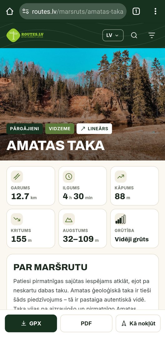
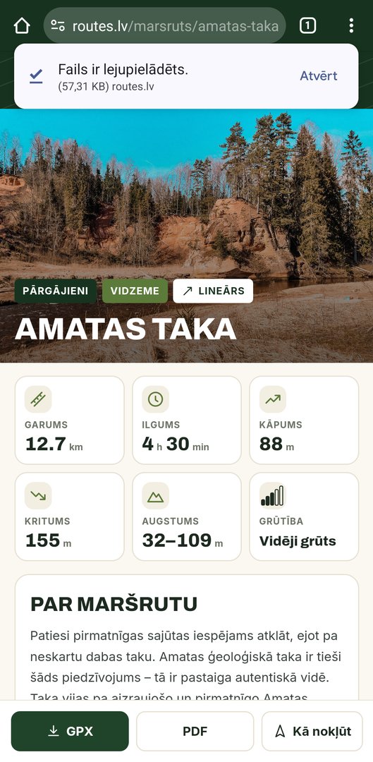
On each route page, below the title and the indicators, there is a GPX button with a download icon. The downloaded file is named after the route, for example amatas-taka.gpx. Next to it are a PDF button for printing and a How to get there menu, which opens the way to the starting point in Google Maps, Apple Maps or Waze. These apps help you get to the start, but they do not help you follow the path.

On an Android phone
-
Download
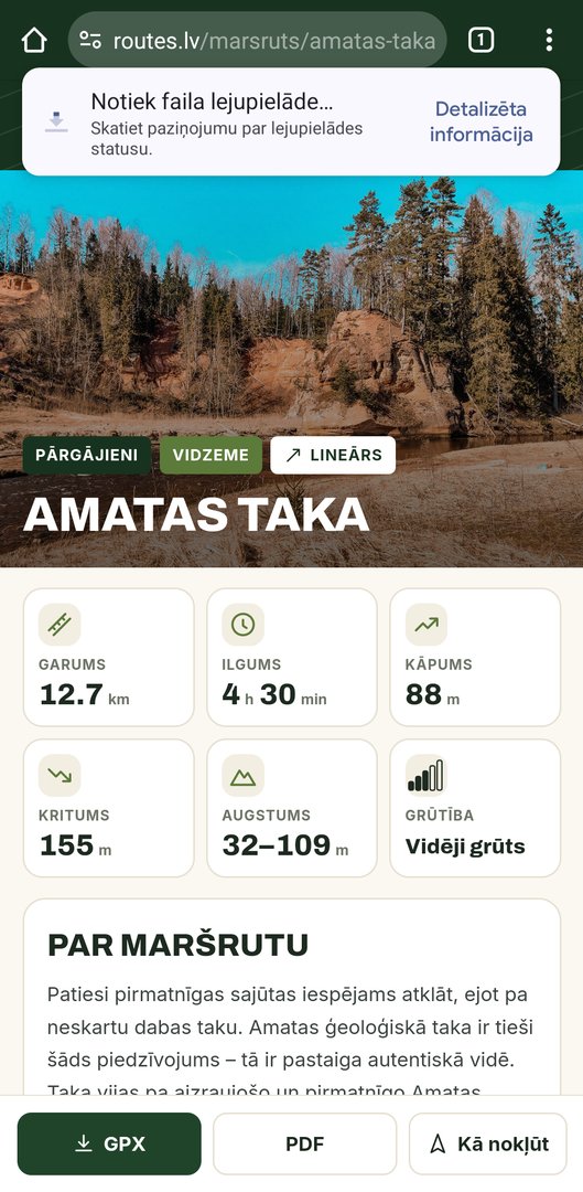
In the browser, press the GPX button on the route page. When the download is complete, a notification appears at the bottom of the screen.
-
Open
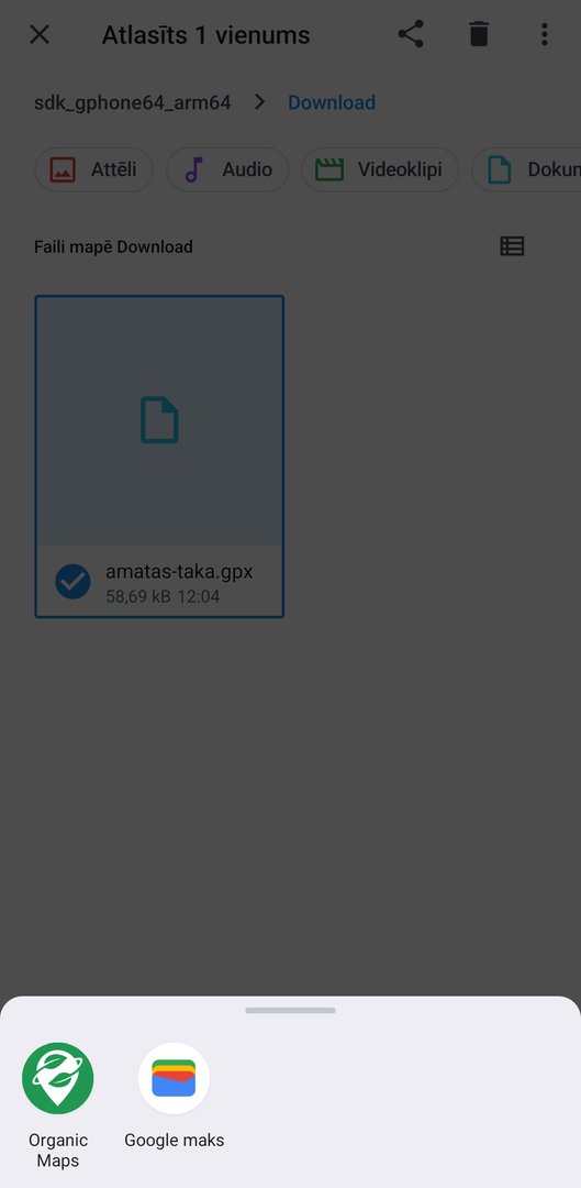
In the notification, press Open. If the notification has disappeared, the file is in the Files app, in the Downloads folder.
-
Choose an app
In the list, choose a map app, for example OsmAnd. If the phone tries to open the file with a browser or a text viewer, see the section on the most common problems.
-
Check on the map
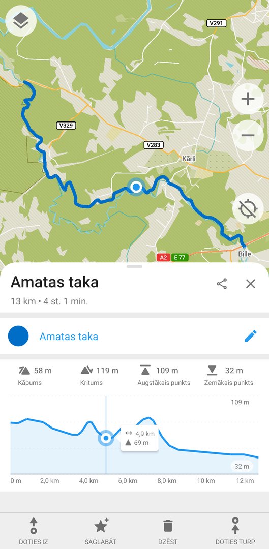
The app shows the line on the map. OsmAnd first offers to import the file. The track is then saved in the My data section and can also be opened later without internet.
On an iPhone
-
Download
In the Safari browser, press the GPX button and confirm the download.
-
Find the file
The iPhone does not open the file automatically but saves it in the Files app, in the Downloads folder. It can also be opened from the list of downloads in the Safari address bar.
-
Share with an app
Tap the file, press Share (a square with an upward arrow) and choose a map app. If it is not in the list, scroll to the end and press More.
-
Or import from the app
If sharing does not work, open the map app and import the file from its menu. For example, in OsmAnd: Menu → My data → Import.
Which app to choose
All the apps listed below show the GPX track on the map together with your location. They differ in what is available free of charge and whether the app can guide you along the track, that is, warn about deviation and show the remaining distance. The information corresponds to the developers’ data as of October 2026. Prices and conditions change, so check them in the app store before subscribing.
| Application | Platform | Free of charge | Paid | Following a GPX route |
|---|---|---|---|---|
| OsmAnd | Android, iPhone | Offline maps (7 downloads on Android, 5 on iPhone), GPX import, navigation | Maps+ or Pro: unlimited maps, contour lines, relief | Yes, free of charge: navigation along the route with voice prompts and recalculation if you go off course |
| Organic Maps | Android, iPhone | Everything: offline maps, GPX import, no advertisements | — | The route is only displayed on the map; there is no navigation along the route |
| Mapy.com | Android, iPhone, web | Offline maps for one country, GPX import and export | Premium: unlimited offline maps, more extensive planning | The imported route is displayed on the map |
| Locus Map 4 | Android (iPhone: Locus Map Lite) | Offline LoMaps maps, GPX import, navigation | Silver, Gold: additional functions, such as hillshading, sensors, synchronisation | Yes, guidance along the route |
| Wikiloc | Android, iPhone, web | Offline maps; GPX upload as your own path and following your own paths | Premium: downloading other users’ paths, off-course alerts | Yes; Premium is required for other users’ paths |
| AllTrails | Android, iPhone, web | Path maps online, GPX upload as your own route | Plus or Peak: offline maps, wrong-turn alerts | Yes; off-course alerts only with Plus |
| Gaia GPS | Android, iPhone, web | GPX import, recording, Gaia Topo map online | Premium: offline maps, map layers | Yes |
| komoot | Android, iPhone, web | Planning, navigation, GPX import, offline maps for one region | Premium: all maps; for new users also sending to a watch or cycle computer | Yes, with voice prompts |
| Strava | Android, iPhone, web | Activity recording | Subscription: route creation, including from a GPX file (on the website), offline routes | Yes, with a subscription |
| LVM GEO | Android, iPhone | Maps of Latvia (topographic, orthophoto, forest maps), offline maps, opening and exporting GPX, KML and KMZ files | — | The route is displayed on the map together with your location |
If you need the simplest solution, choose Organic Maps: open the file and the line appears on the map. If you need free navigation along the route, choose OsmAnd or Locus Map (Android).
LVM GEO is a free maps application of the joint stock company “Latvijas valsts meži”, designed specifically for Latvia. It contains detailed topographic maps of Latvia, orthophoto maps and forest maps, which also show forest roads, rides and ditches that are often missing from other maps. A GPX file can be opened in LVM GEO in the same way as in other applications — the route appears on the map together with your location, and the maps can be downloaded for use without internet. Lines and points that you draw yourself can be saved and exported in GPX or KML format.
Download links
- OsmAnd: Android, iPhone
- Organic Maps: Android, iPhone
- Mapy.com: Android, iPhone
- Locus Map 4: Android
- Wikiloc: Android, iPhone
- AllTrails: Android, iPhone
- Gaia GPS: Android, iPhone
- komoot: Android, iPhone
- Strava: Android, iPhone
- LVM GEO: Android, iPhone
Google Maps and Apple Maps
The maps built into a phone are convenient for getting to the starting point, but they are not suitable for a GPX route. A GPX file cannot be opened in the Google Maps and Apple Maps applications. In Apple Maps you can create your own hiking route and download maps for offline use, but this is not the same as following a ready-made route.
On a computer
On a computer, it is easy to view the route, compare it with other maps, print it or modify it before transferring it to a device.
- gpx.studio is a free, open-source GPX editor that runs in a browser. It allows you to view the track and elevation profile, shorten or merge files and export the result.
- Google My Maps (a Google account is required) allows you to create a new map and click Import to add a GPX file. The map can be shared with others or printed.
- Google Earth: the web and mobile versions do not import GPX directly, only KML and other formats. A GPX file can be opened with the desktop program Google Earth Pro, in which the track can be viewed in three dimensions.
- Mapy.com imports GPX on the web after you log in to your account, and the route is synchronised with the phone app.
GPS watches and devices
Most hiking and cycling GPS devices and sports watches can open GPX tracks. The track is usually sent to a watch via the manufacturer’s app on the phone.
- Garmin watches and cycle computers: on the Garmin Connect website, open Training & Planning → Courses and click Import. The saved course is synchronised with the device. For Garmin handheld GPS devices, the file can also be copied into the device folder Garmin/NewFiles by connecting the device to a computer with a cable.
- Other manufacturers: the apps of other watch manufacturers also usually allow a route to be imported from a GPX file. For the exact steps, see the instructions for your device.
- If you are sending the track from komoot, Wikiloc or another app, check whether sending to a device is a paid feature.
How to follow the track
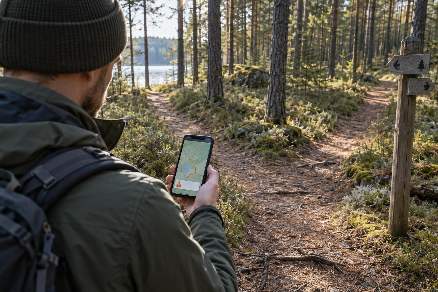
The simplest way is to look at where the blue dot is and stay on the line. It is more convenient to switch on track navigation: the app shows the remaining distance and the next turn, and many apps warn you with a sound or vibration if you have gone off course. For example, AllTrails warns you if you are more than 50 metres away from the route. OsmAnd recalculates the way back to the track.

Offline maps
The GPS receiver in a phone works without mobile internet, but the map will not load without internet if it has not been downloaded in advance. You will then see a line and a dot on an empty background. Therefore, at home, using Wi-Fi:
- download the map of Latvia in your app (in free versions with a limit, select Latvia);
- import the GPX file and check that the track opens without internet, for example by switching on flight mode;
- update the map if it was downloaded a long time ago: paths and roads change.
How to save battery
- Switch off the screen when you are not looking at it and reduce the brightness. The screen is one of the biggest consumers of energy.
- If the mobile network is weak, the phone uses energy searching for it. In flight mode, GPS usually continues to work, but you will not be able to make calls. Switch the network on when you need to communicate.
- Close apps that use location in the background.
- In cold weather, the battery discharges faster. In winter, keep the phone in an inside pocket.
- Take a charged power bank and a cable with you.
Common problems
The file opens as text or in the browser
The phone does not know which app to give it to. Install a map app and open the file from within it or, on an iPhone, using Share. On Android, the default app can be reset in the settings, in the section about apps.
The file name ends with .zip
The file is an archive. Extract it first: on Android in the Files app, on an iPhone by tapping the file in the Files app. Inside there will be a .gpx file.
iPhone: ‘nothing happens’
The file has been downloaded but only saved. Look for it in the app under Files → Downloads.
The line is there, but there is no map
An offline map has not been downloaded, and there is no internet. See the section about offline maps.
The line is slightly to the side of the path
In an open area, a phone’s GPS is usually accurate to within a few metres, but in a forest, among trees and buildings, the accuracy is poorer. The track itself was also recorded with the same accuracy, so minor deviations are normal. Navigate by the path on the ground.
The navigation leads elsewhere than the line shows
The app has converted the track into a route along its own roads. Switch off attachment to roads or choose to follow the track instead of route calculation.
Safety in nature
- Tell someone where you are going and when you plan to return.
- Take a charged phone with you. In an emergency, call 112.
- In the app you can view the coordinates of your location. They will be useful if you need to explain to rescuers where you are.
- Follow the waymarking on site. If it differs from the track, the waymarking takes precedence.
Routes with GPX files can be found in the sections Hiking, Cycling routes, Boats and SUP.
Sources
- GPX 1.1 schema (TopoGrafix)
- OsmAnd: Android Purchases
- OsmAnd: iOS Purchases
- OsmAnd: Navigate by Track
- Organic Maps: GPX imports (news of 7 June 2023)
- Organic Maps: discussion on navigation along an imported track
- Mapy.com: help and FAQ
- Locus Map: Premium
- Wikiloc: How to upload a trail from a GPX file
- Wikiloc: What can I do with the free App?
- AllTrails: Uploading files to AllTrails
- AllTrails: How to download maps for offline use
- AllTrails: Wrong-turn alerts
- Gaia GPS: Membership options
- komoot: Hiking app with offline maps
- BikeRadar: New komoot users face a fee to send routes to devices
- Strava: Uploading route files
- Strava: Subscription features
- LV portāls: LVM GEO app partially restored (2026)
- LV portāls: LVM GEO offers new features (GPX export)
- Google: My Maps — importing (supported formats)
- Google Earth: Import data (supported formats)
- gpx.studio source code (MIT licence)
- Apple Newsroom: Apple Maps introduces new ways to explore the world (2024)
- GPS.gov archive: GPS Accuracy
- LVM GEO Mobile — lvmgeo.lv
- LVM: new features in the LVM GEO mobile app (2022)